 Posted by Ewan
(here)
Posted by Ewan
(here)
Posted by jaybee
(here)
.
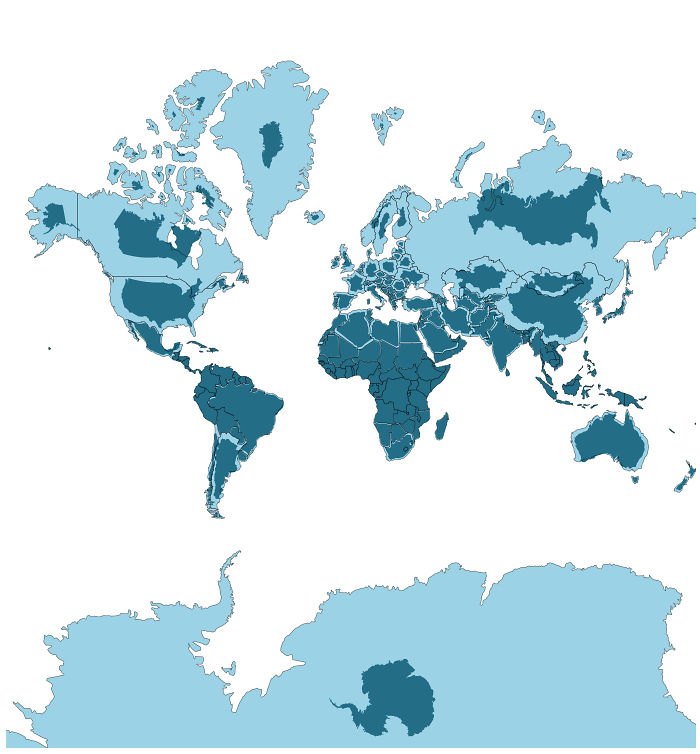
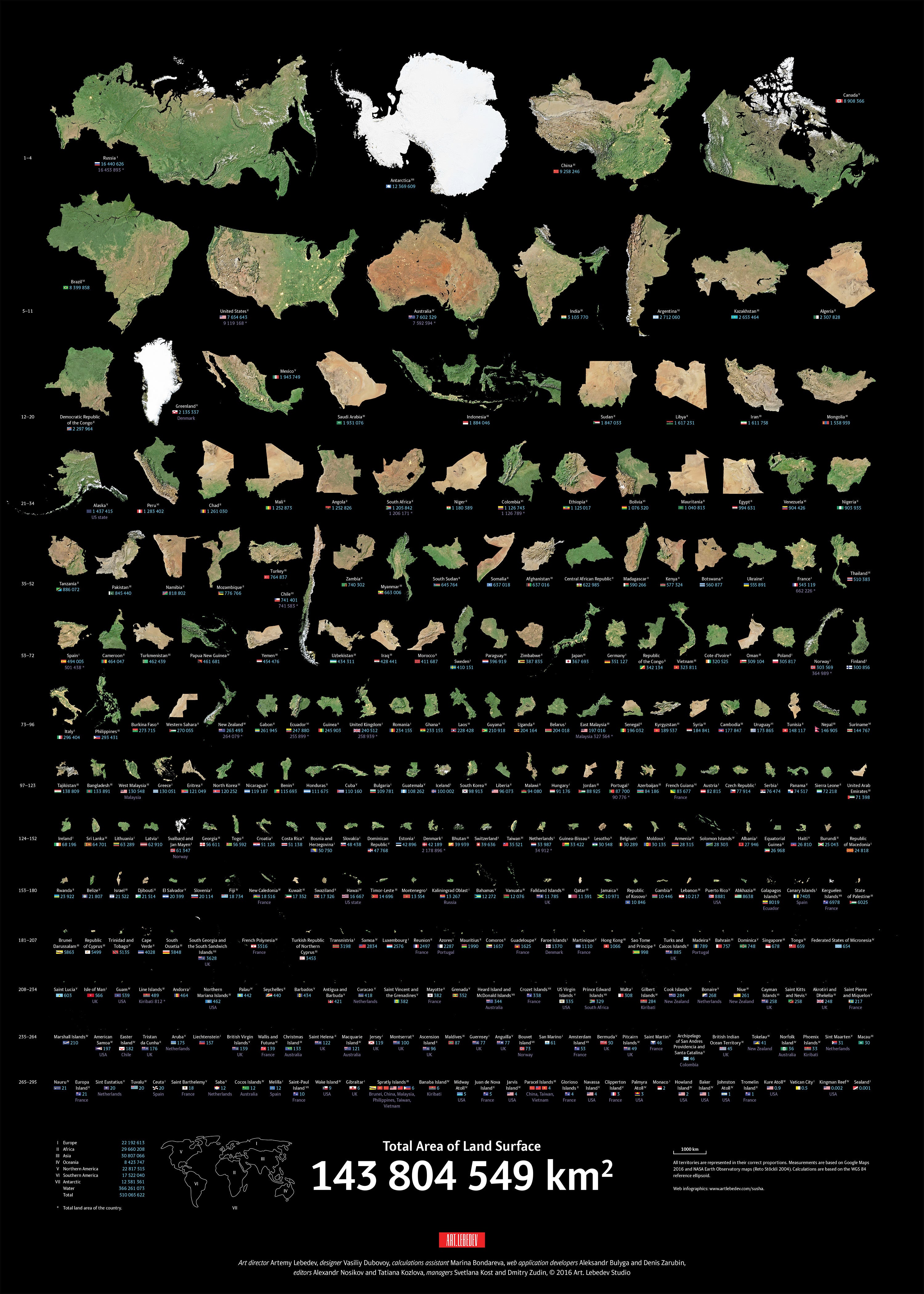
so the dark blue in the OP map is the actual size of the
land mass rather than the total area of the whole country + boundary.... ?
I'm just thinking aloud.... carry on.....

Posted by thepainterdoug
(here)
so if we did that to our human bodies eliminating water from land, wed be a sugar cube size of solid material? am I getting this right?
Umm, no, sorry guys. (Unless it is me who has totally misunderstood what I am looking at).
It has nothing to do with removing water or total area + boundary.
Yes, the dark blue on the map is the ACTUAL size of the
country relative to the other countries, (also displayed at their correct size).
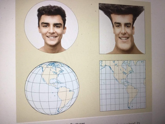
The only way to correctly view the world would be on a globe, there is no way to lay a sphere flat on a plane without lots of empty space that doesn't exist on the original globe. That is why all maps are 'projections', the Mercator Projection is just one kind but by far the most commonly used.
Therefore, on the projection of the map we are used to viewing the further away you are from the equator the more distortion there is relative to reality. If you look at the original image I posted you can see that pretty much everything between the two tropics are barely distorted if at all.


 Reply With Quote


Bookmarks