


Guagua Pichincha volcano very close to the city of Quito, Ecuador is starting to show signs of seismic activity right after the other two active volcanoes in Ecuador, Reventador to the north-northeast, and Tungurahua to the south very rapidly showed diminished activity.
Earlier in the month of February, Tungurahua created a spectacular display of eruption, ash, pyroclastic flow, and SO2 emission. Reventador (north of Tungurahua) started increasing activity as Tungurahua's magma channels switch, then diminished suddenly.
As Reventador's activity (to the N-NE of Guagua Pichincha) suddenly diminished, this volcano to the west started to show seismic signs, possibly indicating an awakening and activity.
This volcano should be watched closely considering the proximity to Quito.
(above seismic activity from yesterday, the sensor network in Ecuador was off-line yesterday evening and didn't come back online until about 0100 AM local time). Rumbling was indicated showing magma was moving at the volcano deep underground.
1999 eruption
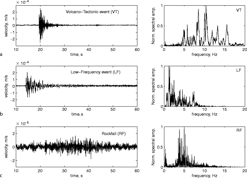
Below are today's seismic activity. Any larger longer duration peaks (for several seconds) are indicative of magma activity.
(see above) - Events started showing up about 1020 AM local time, and continued every hour for 3-5 minute bursts.
Guagua Pichincha is one of Ecuador's most active volcanoes.
The stratovolcano is part of a complex that rises immediately west of the capital Quito, at only 8 km distance from the city center. 3 major explosive eruptions have occurred at Guagua Pichincha in the past 2000 years, the most recent one in 1660. An event of similar size today is a major threat to the ca. 2 million city of Quito.
The volcano and the older extinct Rucu Pichincha stratovolcano form a broad volcanic massif 23 km in diameter. Historical activity of the volcano has included large explosive eruptions some of which produced sub-plinian and plinian eruption columns, lava domes.
Guagua Pichincha volcano's eruptions frequently produce dangerous pyroclastic flows.
Following a 100 year long interval of being dormant, Guagua Pichincha volcano has entered a new phase of low seismic, phreatic and magmatic activity in 1981.
Background:
(from Smithsonian / GVP volcano information)
A lava dome is located at the head of a 6-km-wide breached caldera that formed during a late-Pleistocene slope failure of Guagua Pichincha about 50,000 years ago.
Subsequent late-Pleistocene and Holocene eruptions from the central vent in the breached caldera consisted of explosive activity with pyroclastic flows accompanied by periodic growth and destruction of the central lava dome. Many minor eruptions have occurred since the beginning of the Spanish era at Guagua Pichincha, which is one of Ecuador's most active volcanoes.
The largest historical eruption took place in 1660, when ash fell over a 1000 km radius, accumulating to 30 cm depth in Quito. Pyroclastic flows and surges also occurred, primarily to the west, and affected agricultural activity, causing great economic losses.
Plinian eruptions from Guagua Pichincha
Over the past 2000 years, 3 Plinian eruptions happened at the Guagua Pichincha volcano, in the 1st century AD, in the 10th century, and in AD 1660. The eruptions produced plinian eruption columns of 25-30 km height and left well-defined fallout pumice layers covering the upper slopes of the volcano. The 10th century eruption was the largest, with a VEI of 5.
(C. Robin et al. (2008) "Late Holocene phases of dome growth and Plinian activity at Guagua Pichincha volcano (Ecuador)", Journal of Volcanology and Geothermal Research, 176, pp. 715)
2008 eruptions
7 phreatic eruptions occurred at Guagua Pichincha Volcano on 1 February 2008. The eruptions were preceded by a magnitude 4.1 earthquake on 6 December 2007.
2003 possible eruption
On 17 April 2003, seismic signals were detected that could have accompanied a minor eruption at Guagua Pichincha, but there was no visual confirmation that an eruption happened.
2002 eruption
On 11 October 2002, 4 phreatic eruptions occurred after several days of heavy rainfall. The eruptions ejected blocks 100-200 m from the vent. Long-period and volcano-tectonic earthquakes and continuous background tremor were recorded until 17 October.
(Source: GVP monthly volcano activity reports)
2001 eruption - lava dome growth and ash explosions
Guagua Pichincha's activity in early 2001 consisted principally of gradual lava dome growth. There were ash eruptions on 18, 31 March, and 25 May 2001. The explosion on 25 May produced a ash cloud reaching an altitude of 8.5 km. On 26 November 2001, seismic signals indicated a 20 minute-long phreatic explosion around noon, followed by 16 hours of continuous tremor.
2000 eruptions
During 2000, Guagua Pichincha produced a series of mostly minor ash explosions. A partial collapse of its lava dome which grew in December 199 and January ("dome 8") occurred on 12 July.
1997 phreatic eruptions
During March-October 1997, Guagua Pichincha produced a series of phreatic explosions. The eruptions occurred without any precursory warning signal. Their intensity peaked in May 1997 and the last one was recorded on 18 October 1997. This activity resembled phreatic explosions that occurred in 1981, 1990, and 1993.
1993 eruptions and fatalities
A phreatic explosion at 11h46 local time on 12 March 1993 from Guagua Pichincha's central dome killed 2 young volcanologists. A warning of possible activity had been transmitted to them by radio at 10h30, but for unknown reasons they were still on the lava dome when the eruption occurred.
(source: GVP monthly volcanic activity reports)
1981 reawakening after 100 years of slumber
New activity started in 1981 with phreatic ash explosions and an increase in fumarole activity. This was the first activity after about 100 years of dormancy and started a new cycle of activity.
References: List of Volcanoes ECUADOR -
http://en.wikipedia.org/wiki/List_of...oes_in_Ecuador
http://www.volcanodiscovery.com/guagua_pichincha.html - Volcanic Discovery (dot com)
Seismic graphics from the Geologic Institute, Ecuador -
http://correo.igepn.edu.ec/heli/heli...2014030400.gif
http://correo.igepn.edu.ec/heli/heli...2014030412.gif
http://www.igepn.edu.ec/ - Geophysical Institute
Ecuador is far from being a stable region, as shown on this seismic map pointing out the locations of earthquake activity (the map is current and goes back 30 days to start of February 2014) - reference above from the Geophysical Institute page.
- Home
- Forum
- Chat
- Donate
-
Site Links

-
Avalon Library
-
External Sites
- Solari Report | Catherine Austin Fitts
- The Wall Will Fall | Vanessa Beeley
- Unsafe Space | Keri Smith
- Giza Death Star | Joseph P. Farrell
- The Last American Vagabond
- Caitlin Johnstone
- John Pilger
- Voltaire Network
- Suspicious Observers
- Peak Prosperity | Chris Martenson
- Dark Journalist
- The Black Vault
- Global Research | Michael Chossudovsky
- Corbett Report
- Infowars
- Natural News
- Ice Age Farmer
- Dr. Joseph Mercola
- Childrens Health Defense
- Geoengineering Watch | Dane Wigington
- Truthstream Media
- Unlimited Hangout | Whitney Webb
- Wikileaks index
- Vaccine Impact
- Eva Bartlett (In Gaza blog)
- Scott Ritter
- Redacted (Natalie & Clayton Morris)
- Judging Freedom (Andrew Napolitano)
- Alexander Mercouris
- The Duran
- Simplicius The Thinker


 Reply With Quote


Bookmarks